×
Warning message
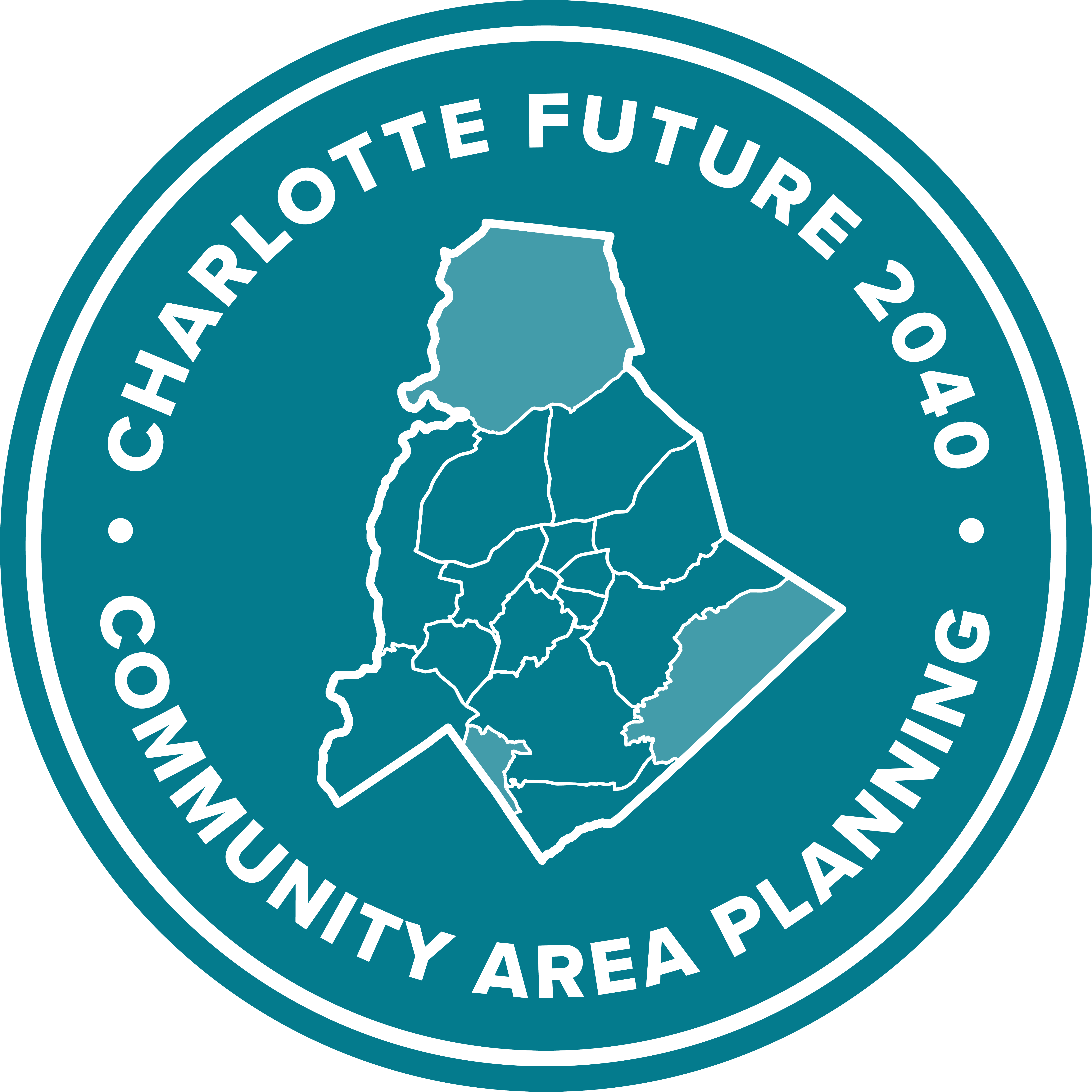
The installed version of the browser you are using is outdated and no longer supported by Konveio. Please upgrade your browser to the latest release.West Outer
On November 24, 2025, Charlotte City Council decided to delay action on the West Outer Community Area Plan and the Revised Policy Map for this area to allow for more community input.
Additional engagement opportunities are being planned, and more information will be posted on the project website.
This draft plan for will stay on this website until Council makes a final decision.
Commenting is closed for this document.
Joni Oleson Jul 17 2025 at 3:43PM on page 48
Suggestion
Beyond traditional recreational facilities, I propose that the Community Development Plan strategically expand our community's disc golf park offerings. Disc golf has witnessed explosive growth in popularity, offering an accessible, low-impact, and environmentally friendly outdoor activity for residents of all ages and skill levels.
The success of Charlotte, North Carolina's disc golf scene, particularly at Hornet's Nest Park on Beatties Ford Road and Nevin Community Park, serves as a powerful testament to the potential of well-developed disc golf infrastructure. Hornet's Nest and Nevin are not just beloved local courses; they have achieved national and international recognition, consistently hosting professional disc golf events, including past Disc Golf Pro Tour Championships and World Championships. These courses have transformed the area into a destination for players and fans alike, drawing visitors from across the region and beyond, and significantly contributing to the local economy.
Adding more disc golf parks to our community would yield numerous benefits:
Enhanced Recreational Opportunities: Provide diverse and affordable outdoor recreation for individuals, families, and groups, promoting physical activity and mental well-being. Disc golf courses can effectively utilize land that may not be suitable for other traditional sports, such as wooded areas or sloped terrain.
Increased Park Utilization: Revitalize underused parkland and open spaces, attracting more residents to enjoy our public amenities and fostering a greater sense of community engagement. Increased activity in parks often correlates with a decrease in vandalism and other undesirable behaviors.
Economic Stimulus: Similar to the positive economic impact seen in Charlotte with Hornet's Nest and Nevin Parks, new or improved disc golf courses can attract regional tournaments and events. These events bring in participants and spectators who spend money on lodging, food, retail, and transportation, generating revenue for local businesses and potentially contributing to local tax bases. Professional disc golf events can have an economic impact of hundreds of thousands to millions of dollars.
Low Cost and Maintenance: Compared to many other sports facilities, disc golf courses are relatively inexpensive to install and maintain. They require minimal infrastructure and can often be sustained with the support of dedicated local disc golf clubs.
By investing in the development of additional disc golf parks, we can tap into a thriving recreational trend, enrich the lives of our residents, and potentially create new economic opportunities for our community.
Joni Oleson Jul 17 2025 at 3:33PM on page 34
Suggestion
I would like to commend the comprehensive nature of this plan and its forward-thinking approach to our community's future. As we look towards sustainable growth and enhanced quality of life, I strongly advocate for the inclusion of a more robust strategy regarding electric vehicle (EV) charging infrastructure.
The rapid adoption of electric vehicles is a critical step towards reducing our carbon footprint, improving air quality, and fostering economic resilience. To truly support and encourage this transition, our community development plan should explicitly address the need for a significant increase in publicly accessible EV charging stations.
Specifically, I recommend that the plan consider the following:
Goals for EV Charging Station Density: Establish clear, measurable goals for the number of charging stations per capita or per square mile within the next 5, 10, and 15 years.
Strategic Placement: Prioritize the installation of charging stations in key locations such as:
Municipal parking lots and garages
Community centers and public facilities
Commercial districts and shopping centers
Multi-family residential developments (through incentives or requirements)
Major transportation corridors
Variety of Charging Levels: Ensure a mix of Level 2 (AC) and DC Fast Chargers to meet diverse user needs and charging durations.
Incentives and Partnerships: Explore opportunities for public-private partnerships, grants, and incentives to encourage businesses and property owners to install charging infrastructure.
Integration with Renewable Energy: Where feasible, consider integrating charging stations with renewable energy sources like solar canopies.
Future-Proofing: Allocate space and infrastructure for future expansion as EV adoption continues to grow.
By proactively integrating a comprehensive EV charging infrastructure plan, we can position our community as a leader in sustainability, attract new residents and businesses, and enhance the convenience and accessibility for all electric vehicle owners. This investment will undoubtedly yield long-term benefits for our environment, economy, and community well-being.
Thank you for your consideration of this vital addition to the Community Development
George Pearkes Jul 15 2025 at 5:05PM on page 40
Suggestion
I agree with Allison, the other commenter near this. Connecting to Long Creek Greenway is an absolutely critical and very low cost way to generate transportation flexibility and equity for the neighborhoods around the intersection of NC16 and Mt Holly-Huntersville Rd
George Pearkes Jul 15 2025 at 5:03PM on page 30
Suggestion
I would love to see more integrated sidewalk infrastructure so this sort of vision is possible. Many areas of West Outer have fantastic sidewalk infrastructure, for instance inside neighborhoods or around newly developed commercial areas. But those networks are typically islands and major connecting roads often have no sidewalk let alone a bike lane. Please prioritize adding sidewalk to connect areas with existing sidewalk networks.
George Pearkes Jul 15 2025 at 5:00PM on page 24
Support
This is all great, I love it.
George Pearkes Jul 15 2025 at 5:00PM on page 21
Suggestion
I like the high percentage growth for neighborhood 2 types but I would like to see an even more ambitious goal, supported by better combined use development that integrates local commercial services like food retail, medical services, and general purpose retail with residential. There are numerous medium density developments going up in West Outer (especially along Mt Holly-Huntersville Rd) and that is GREAT but there need to be integrated commercial areas as well, especially walkable or bikeable to that residential.
in reply to anonymous 's comment
Brian Clarke Jun 24 2025 at 8:17AM on page 14
Agreed! The northern part of this area has VERY different needs and issues than the southern part. Just because they are on the "outer west" edge of the city does not make them the same.
Brian Clarke Jun 24 2025 at 8:16AM on page 14
Concern
This area needs access to amenities far more than more huge warehouses.
Brian Clarke Jun 24 2025 at 8:15AM on page 14
Concern
Whole neighborhoods in this area are being destroyed for industrial development.
Brian Clarke Jun 24 2025 at 8:15AM on page 14
Concern
While "access to jobs" is important throughout the county, they should be the right jobs in the right places. This assessment of community needs does not account for that. Further, the development occurring in this area is focused largely on low pay, dirty jobs or automated, low employment development. For example, the intermodal rail yard is highly automated. Amazon distribution centers are notoriously low pay. Industrial development is largely low pay and dirty. Further, all of these large, warehouse style development REMOVE things that make this area of the county special -- NATURE, HISTORY, EXISTING NEIGHBORHOODS, TREES, CREEKS, ETC.
Housing is LITERALLY being destroyed to build warehouses. Forests are being clear cut for same. Historic sites ditto. Whole communities ditto. Its disgraceful.
When I discussed some of these issues with the petitioner for a rezoning from R3 residential to industrial, the response was that poor people live nearby who may want to work in the warehouse complex to be built. WHAT??? Yet this is what the 2040 plan appears to encourage.
Soon, however, industrial creep will drive out the nearby residents and drive down all the other measures.
Forest is not "unused" or "vacant" land. It is a critical land use and often the backbone of the community.
Neighborhoods are not
Kelly May 8 2025 at 8:02PM on page 61
Suggestion
I agree that the historical and peacemaking in the Mountain Island Lake area is lacking. We have history in our area like the lake, ferry, drag way….that long time residents can tell everyone about but there is no art or signage or placemaking to support it. This is easy to remedy. The parks in the area are a good place to start but the CAC intersection of 16 and MHH road is another lost opportunity. Most of what is visible is power right of ways that are not landscaped. Signage/art at the 16/MHH intersection that identifies the Mtn island community would be a great start. That and getting Duke/commercial owners at most corners of that important intersection to help with this placemaking would be a great start that seems easy to implement and would be a huge step forward in community character building. Happy to help.
I also agree with many of my neighbors comments about needed oversight/following of implementation concerns noted here in the significant rezoning activity in our area. Also connecting to greenways - both Charlotte and neighboring Mt Holly,….
I also agree with many of my neighbors comments about needed oversight/following of implementation concerns noted here in the significant rezoning activity in our area. Also connecting to greenways - both Charlotte and neighboring Mt Holly,….
Jane johnson May 3 2025 at 6:59AM on page 40
Concern
I've lived in this area 60 yrs.
anonymous May 3 2025 at 5:44AM on page 54
Suggestion
environmental justice should always be a central priority, not something that gets pushed down the list based on survey averages across an overly broad region. Every development decision has an environmental impact—whether it's on tree canopy, water resources, air quality, or noise—and these effects are disproportionately felt in certain communities. We cannot afford to let environmental concerns be diluted by flawed area definitions or priority rankings.
anonymous May 3 2025 at 5:12AM on page 30
Concern
While the long-term vision laid out in the plan is admirable in principle, it is deeply disconnected from the current reality on the ground—especially when it comes to infrastructure. Our roads and transportation systems are already strained under existing zoning, and the plan’s recommendations for increased density are simply not feasible without major investment in infrastructure first.
It is extremely disappointing that neither the city nor the state has prioritized road improvements in this area, despite rapid development. Longtime residents are now bearing the burden of this oversight—dealing with worsening traffic, longer commutes, and safety concerns, all while new developments continue to be approved.
Before any increases in density are implemented, there must be a clear, funded plan to upgrade infrastructure to meet both current and future demand. Otherwise, the promises of livability and connectivity in the plan will ring hollow for the communities most impacted.
anonymous May 3 2025 at 5:06AM on page 27
Suggestion
A critical issue missing from this plan is the prioritization of entitlements in all development scenarios. In our area, we have consistently seen new developments move forward without meaningful community benefits— no infrastructure investments and no public space improvements. Meanwhile, similar projects in other parts of Charlotte routinely include these kinds of entitlements.
This disparity is unacceptable and undermines trust in the planning process. If the city is serious about equity, then entitlements should not be optional or selectively applied—they must be a standard requirement for development in all communities. Every neighborhood deserves to benefit from growth, not just absorb its impacts.
This disparity is unacceptable and undermines trust in the planning process. If the city is serious about equity, then entitlements should not be optional or selectively applied—they must be a standard requirement for development in all communities. Every neighborhood deserves to benefit from growth, not just absorb its impacts.
anonymous May 3 2025 at 5:02AM on page 14
Concern
Another major concern I have is how the city’s grouping of neighborhoods into broad, inconsistently defined “areas” has skewed the assessment of community needs and goals. For example, stating that “access to jobs” is the top priority in the West Outer area does not accurately reflect the priorities in my specific area. Lumping together such a wide range of communities under one label erases important local differences and results in a plan that doesn’t represent the actual needs of residents.
In addition, environmental justice should always be a central priority, not something that gets pushed down the list based on survey averages across an overly broad region. Every development decision has an environmental impact—whether it's on tree canopy, water resources, air quality, or noise—and these effects are disproportionately felt in certain communities. We cannot afford to let environmental concerns be diluted by flawed area definitions or priority rankings.
I urge the city to revisit how areas are defined, and to ensure that both community-specific priorities and environmental justice are given the weight they deserve.
anonymous May 3 2025 at 4:50AM on page 2
Concern
I would like to express my concern about the way the city groups neighborhoods into “community areas” for planning purposes. The boundaries and naming conventions used by city staff are confusing, constantly shifting, and do not reflect how residents actually understand or refer to their communities. These groupings seem to change from one plan or initiative to the next, making it difficult for the public to follow along or remain engaged over time.
Why not use a system that is more familiar and stable—like ZIP codes? These are the geographic references that people use every day, and they would provide a consistent and relatable framework for residents to understand how plans affect their area. Consistency and clarity are critical for public trust and participation. Please consider revising the area designations to something that makes sense to the people who actually live here.
Why not use a system that is more familiar and stable—like ZIP codes? These are the geographic references that people use every day, and they would provide a consistent and relatable framework for residents to understand how plans affect their area. Consistency and clarity are critical for public trust and participation. Please consider revising the area designations to something that makes sense to the people who actually live here.
George Pearkes Apr 24 2025 at 7:22PM on page 88
Support
This vision of pedestrian-oriented medium density development that would be a five minute bike ride from my house is one of the most exciting things I can recall ever seeing in a planning document. The Riverbend Village development has been a huge boon to the area and I regularly walk, bike, and drive to it. Imagining the development as a multi-modal destination with much denser services is brilliant.
George Pearkes Apr 24 2025 at 7:13PM on page 44
Suggestion
Outer West is in desperate need of better connectivity for bikes. A good example is the area around Brookshire/Mt Holly Huntersville. Excellent sidewalk and arterial crossing infrastructure is underutilized in part because the local sidewalk network does not connect to many nearby neighborhoods. Until Mt Holly-Huntersville and Bellhaven/Rozelles Ferry have sidewalks to connect to the under construction greenway at Oakdale and planned expansion to Shuffletown Park, residents will be forced to drive to reach major commercial clusters like the Northlake mall area or the broader greenway network.
Martha Eppes Apr 16 2025 at 12:22PM on page 51
More connection and greenways are needed on outer west. Why not connect Iswa with 0S7?
Martha Eppes Apr 16 2025 at 12:20PM on page 35
There should be greenway along the Catawba River south and north of Wilkinson
Rebekah Apr 14 2025 at 10:26AM on page 21
Can there be a different photo used?
Anonymous Apr 7 2025 at 1:52PM on page 91
The draft plan, as presented, appears to incorporate little—if any—meaningful community feedback. Much of the content simply repackages existing community data and translates the 2040 Comprehensive Plan into more localized terms, without reflecting the unique input or priorities expressed by stakeholders.
Furthermore, the proposed timeline raises serious concerns. With the public comment period set to close on May 9th and Council action expected just weeks later on May 27th, there is insufficient time to adequately review public input, assess its implications, and make any necessary revisions to the plan. This expedited schedule gives the impression that public engagement is more procedural than purposeful.
Furthermore, the proposed timeline raises serious concerns. With the public comment period set to close on May 9th and Council action expected just weeks later on May 27th, there is insufficient time to adequately review public input, assess its implications, and make any necessary revisions to the plan. This expedited schedule gives the impression that public engagement is more procedural than purposeful.
Anonymous Apr 7 2025 at 1:44PM on page 88
Why are we planning the re-development of a site that was built within the last 5-6 years?
Anonymous Apr 7 2025 at 1:34PM on page 86
This image 2+ years old.
Anonymous Apr 7 2025 at 1:31PM on page 84
This area is shown as Manufacturing & Logistics on Map 14.
Anonymous Apr 7 2025 at 1:10PM on page 49
How will these aspirations be achieved? 15% green area is typically required.
Anonymous Apr 7 2025 at 12:10PM on page 49
Street right-of-ways are considered open space?
Anonymous Apr 7 2025 at 12:05PM on page 41
How is this aligned? Because there is a bus stop? There's minimal sidewalk along Mt Holly Road and no place to cross.
Anonymous Apr 7 2025 at 12:02PM on page 41
Bellhaven*
Anonymous Apr 7 2025 at 11:57AM on page 30
As noted earlier, this area is anticipated to see 8% of the city's overall residential growth, but only 2% of the city's total job growth by 2040. How does keeping the Policy Map in line with existing land uses help create a complete community?
Anonymous Apr 7 2025 at 11:52AM on page 20
Owned by the City of Charlotte? or Charlotte Douglas Airport?
Anonymous Apr 7 2025 at 11:42AM on page 11
What does the range represent? The objective of this data point isn't clear. If we're reviewing the area as a whole, why is there not a central median? If you're providing this type of data, you should also provide mapping support to show where the various "median" ranges are located in each area plan location.
Matt Apr 7 2025 at 11:12AM on page 1
Concern
The number one priority in 10 out of the 15 neighborhoods is for housing availability? There is no shortage of housing or apartments we have vancancies because they overbuilt! So the only reasonable conclusion is that the study suggests our housing prices are too high? That's capitalism...you can't control the market prices or the macro-economic environment. Just because I want to live in quail hollow doesn't give me the right or mean they should build cheap duplexes so I can. This study focuses on a far-left socialist agenda rather than real ways to improve the city. Genuinely curious how many tax dollars were spent on this study to tell us we need more of this race here and that race there. Charlotte councilemen let me save you some of our money in the future build bike lanes and improve walkability.
Phyllis Sitler Apr 6 2025 at 5:15PM on page 91
Suggestion
General comments for West Outer:
The intersection at Brookshire Blvd and Mt Holly-Huntersville is NOT better with the recent re-design and should be considered for improvement in this plan.
Any intersection improvements within the plan should include smart traffic light timing.
Hopefully the latest technologies will be used for the entire plan with data collected over a year, at minimum.
Phyllis Sitler Apr 6 2025 at 5:07PM on page 88
Concern
Are the proposed structures near the Harris Teeter parking garages? This parking lot is PACKED at any given time serving HT and the rear facing businesses. Plans should also include relocation of popular restaurants being displaced, remaining within RB Village.
Allison Apr 4 2025 at 1:26PM on page 40
Suggestion
I suggest we add an access point to the Long Creek Greenway here- This would allow people to access the greenway safely plus have pedestrian and bicycle access to the grocery store.
View all
Comments
View all Cancel